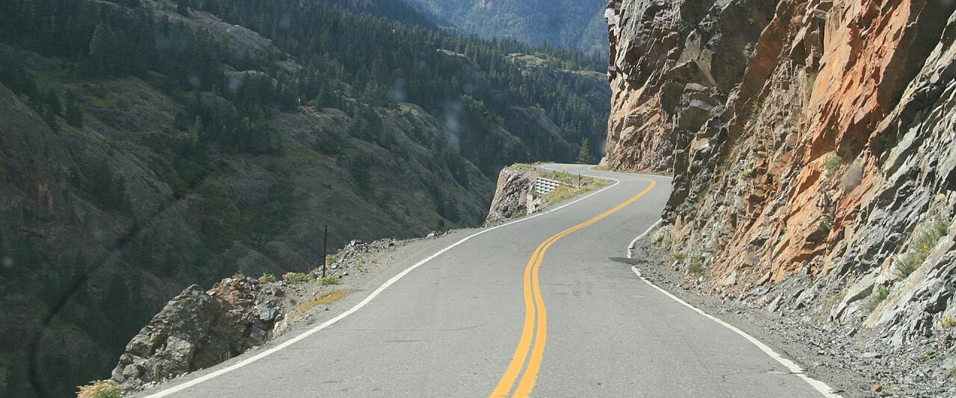
Colorado's best scenic drives cross high passes, and most of the famous ones are seasonal. Trail Ridge Road in Rocky Mountain National Park, Independence Pass above Aspen, Guanella Pass and the road up Mount Blue Sky all close for winter and generally reopen around Memorial Day. The San Juan Skyway, with its Million Dollar Highway section, and the Peak to Peak Highway stay open year-round but feel very different in snow. For the full set, go between late June and early October. Mid-to-late September adds the aspens turning gold.
Trail Ridge Road (Rocky Mountain National Park)
Route: US 34, 48 miles from Estes Park to Grand Lake across the Continental Divide. Allow about two hours without stops, and realistically half a day.
Why drive it: It's the highest continuous paved road in the US, topping out at 12,183 feet. Eleven miles run above treeline, across alpine tundra that looks more like the Arctic than Colorado. Stop at the Tundra World Nature Trail at Rock Cut (a half-hour walk) and the Alpine Visitor Center, and watch for elk and marmots.
Season and rules: The road closes to through traffic from mid-October to late May. In 2026, park entry between 9 a.m. and 2 p.m. needed a timed-entry reservation from May 22 to October 12. Enter before 9 a.m. and you skip the reservation and most of the traffic. It's normally windy and 20 to 30 degrees colder at the top than in Estes Park. Road status line: (970) 586-1222.
Bonus: Old Fall River Road is the original route, 11 miles of mostly gravel. It's one-way uphill with switchbacks, from Horseshoe Park to the Alpine Visitor Center. It has a shorter season than Trail Ridge, so check the park's road status before you plan on it.
San Juan Skyway and the Million Dollar Highway
Route: A 236-mile loop through the San Juan Mountains linking Durango, Silverton, Ouray, Ridgway, Telluride, Rico and Mancos, which is the turnoff for Mesa Verde. CDOT estimates about six hours of driving, and most people spread it over two or three days. It's a nationally designated All-American Road.
The Million Dollar Highway: US 550 between Ouray and Silverton is the dramatic part. The road is carved into cliffs above the Uncompahgre Gorge and climbs over Red Mountain Pass past old mine workings. Long stretches have sheer drop-offs and no guardrails. Southbound drivers (Ouray to Silverton) are on the outside edge. If that worries you, drive it northbound or ride with someone who's comfortable on it.
Season: Open all year, but in winter it's a serious mountain drive that can close for storms and avalanche control. Fall is the standout season, with aspens against red mountains, usually from mid-to-late September.
Independence Pass (CO 82)
Route: From Twin Lakes over the Continental Divide at 12,095 feet and down into Aspen.
Why drive it: Big views from the top, the Independence ghost town on the Aspen side, and Twin Lakes and the Collegiate Peaks on the east.
Season: CDOT closes the pass every winter, usually in late October or early November. In 2025 it closed November 17. It reopens the week before Memorial Day weekend. While it's closed, getting to Aspen from Denver means going around through Glenwood Springs, which adds hours.
Know before you go: The road is paved but narrow and curvy, with steep drop-offs. Some stretches only fit one vehicle, so take the curves slowly and be ready to yield. It's no place for a big RV.
Mount Blue Sky (formerly Mount Evans)
Route: From Idaho Springs (I-70) up CO 103 to Echo Lake, then CO 5 to just below the summit of Mount Blue Sky. CDOT calls it the highest paved road in North America. The full byway loop through to Evergreen is 49 miles.
Season and rules: The upper road from Echo Lake Lodge to the summit reopened after construction finished in 2025. CDOT scheduled it to open for the 2026 Memorial Day weekend, and the summit is open from Memorial Day through Labor Day only. Vehicle entry requires a reservation on Recreation.gov. Vehicles over 30 feet aren't recommended on CO 5. The lower byway from Idaho Springs to Evergreen Parkway stays open longer. The peak was renamed from Mount Evans in 2023, so older maps and signs still use the old name.
Know before you go: You'll be above 14,000 feet with very little oxygen. Walk slowly at the top and turn back if you get a headache or feel dizzy. Bring warm layers and sunscreen.
Peak to Peak Scenic Byway
Route: 55 miles along the Front Range, from Estes Park south through Allenspark, Ward and Nederland to Black Hawk and Central City (CO 7, 72 and 119). Driving time is about 80 minutes.
Why drive it: It's an easy day from Denver or Boulder, with views of the Continental Divide, and it's at its best during aspen season. Designated in 1918, it's Colorado's oldest scenic byway. Combine it with Rocky Mountain National Park, Golden Gate Canyon State Park or a stop in Nederland.
Season: Open year-round, since it's the main highway through these towns.
Guanella Pass
Route: 22 miles from Georgetown on I-70 over the pass to Grant on US 285, about an hour's drive. The road crosses above treeline between Mount Bierstadt and Mount Blue Sky.
Why drive it: It's a short, paved high-country drive close to Denver. You get beaver ponds, willows, alpine meadows and the trailhead for Mount Bierstadt, one of the most-climbed fourteeners. Start or finish in historic Georgetown.
Season: CDOT closes the road on or about November 26 and reopens it on Memorial Day weekend. Winter gates sit at Naylor Lake on the Clear Creek County side and Burning Bear Campground on the Park County side.
If you have a 4x4: the Alpine Loop
The Alpine Loop links Ouray, Silverton and Lake City over two 12,000-foot passes, Engineer and Cinnamon. It's 63 miles and takes four to six hours, and it needs a high-clearance four-wheel-drive vehicle. Many visitors rent a Jeep or take a guided tour in Ouray instead of using their own car. Standard rental agreements generally prohibit unpaved, off-road driving, so check yours first.
Tips for all of them
- Check closures first. COtrip.org shows state highway status, and each national park has its own road line.
- Start early. Summer afternoons bring thunderstorms and lightning above treeline, plus more traffic.
- Fill up before the pass. Gas stations are scarce between towns.
- Use low gears on the way down so your brakes don't overheat.
- Expect altitude. Several of these roads go above 12,000 feet. Take it easy if you've just arrived from sea level.